
Grizedale - Parkamoor
Lake District Mountain Bike Route Guide
Region:
Grizedale, Southern Lake District
Difficulty:
Difficult
(Requires advanced skills and fittness)
Distance:
17.1 miles
Map:
OS Landranger 96
Route Text Download:
Grizedale – Parkamoor
GPS Download:
GPX and KML
(available via the full MapMyRide page for this route, on the right hand side of the page)
ViewRanger
Grizedale - Parkamoor Route
Back to Lake District
Route Guides
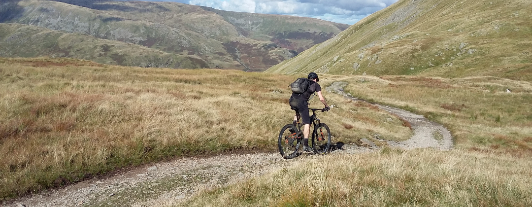
This is a mountain bike route of 17.1 miles starting from the Grizedale Vistors Centre, in the Lake District. The ride begins on the man-made mtb trails of The North Face Trail before heading out across the fells near Coniston Water for some fantastic rocky riding, which makes up the rest of the route. While the Parkamoor descent to High Nibthwaite is the highlight of the ride the ones that follow don't disappoint and there's a real rock fest to finish.
1. Start at the Grizedale Visitor Centre car park (GR336942). Climb out of the car park towards the buildings. At the top of the car park follow the path ahead past the toilet block on the right. At the end of the path turn left to a junction with a lane. Go straight across the junction and follow the lane along the side of the building on the right. Go over the bridge across Grizedale beck then continue along the lane to a junction with a gated, wide hardpack track on the left that is the start of The North Face Trail (GR333942).
2. Go left through the gate and follow The North Face Trail up the wide track that climbs to a junction. Turn right then a short distance later turn left to start the 'Elephants Paradise' singletrack (GR331939). Continue following the singletrack for quite some time as it climbs the hill, to where it ends at a wide forest track (GR328932). Bear left and gently climb the track to a crossroad junction. Go straight on to the next section of singletrack, 'The Great Escape', on the left a short distance later (GR327937). Turn left and follow the singletrack to where it ends at a forest track. Go straight on and climb the track to a crossroad junction (GR323935). Turn right and climb the wide forest track, still following The North Face Trail. After a while go through an ‘S’ bend and past a junction with a track on the left. Continue along the main track to the next junction with a track on the left. Continue ahead along the now flat track to a signposted junction with a track on the left, where the wide forest track bears right (GR318943).
3. Turn left up the bridleway signposted for Parkamoor and climb the singletrack between the trees. This track winds through the trees for some time. At the end of the trees go ahead through a gate then up a hardpack track that climbs to the top of the hill, with great views across Coniston Water and the Old Man of Coniston on the right. Follow the track straight on over the top of the hill then down a long descent to a gate. Go through the gate then follow the grassy track ahead as it descends to the farm buildings of Low Parkamoor. At the buildings go through the gate then down the rocky track to a gate and stream crossing at the bottom. Go through the gate and stream then climb the steep, rocky track ahead to where it ends at a junction with the grassy double track at the top (GR307925).
4. Bear right and follow the double track as it generally descends across the side of the fell. After a while the track bears left up a short climb, the top of which marks the start of the fantastic, rocky Parkamoor descent. Continue following the double track as it descends through some very technical sections of drops, boulders and bedrock. After a while, at the trees, the track turns 90 deg right then descends a steep section of jagged bedrock. After this the track flattens off for a fast undulating section with a few puddles when wet. A while later the track bears right before dropping through a series of steep, rocky corners. After this there is more rocky riding to where the track finishes at a gate in High Nibthwaite (GR294897).
5. Go through the gate then straight on to a junction with a lane. Turn left and follow the lane for a while along the bottom of the valley. Go past a junction with a lane on the right then on to the following junction, at Nibthwaite Grange (GR296881). Turn left and climb the steep lane as it bears left out of the houses. At the junction with a gated track on the hairpin bend climb the steep lane right. Continue climbing the lane to a junction with a forest track on the left, at the top. Continue straight on along the lane for a short distance to where it ends at a junction with a gated track ahead (GR305888).
6. Go straight on through the gate and follow the double track, keeping the trees on the left, to the next gate a little further on. At the junction directly after turn right and follow the signposted bridleway along the double track. Follow the track ahead, negotiating the deep puddles on the way, then go down a short rocky descent. At the bottom go straight on through a gate and climb the rocky double track past the grassy bridleway signposted off to the right. After reaching the top descend to another deep puddle in the bottom of a dip, which has a small stone bridge on the right. Follow the track straight on and climb out of the dip. At the top continue following the track ahead as it goes down a fun, rocky descent that ends at a gated junction with a lane (GR323894).
7. After the gate turn right and follow the lane through a left hand bend. The lane then descends through the trees and a number of bends, which can jump out on you, to a junction at the bottom (GR331893). Turn left and follow the road to the next junction a short distance later. Turn right, then at the next junction a short distance later go straight on. Follow the lane over a river to the next junction (GR336896). Take the lane on the left and go up a short climb to the church at the crest. Continue ahead along the lane and descend to a four way junction, with a rocky track leading to a set back gate on the left (GR340897).
8. Turn left and go through the gate then climb the tricky, rocky double track along the line of the wall on the left. At the top follow the gravel track straight on, which soon starts descending before coming to a junction (GR340908). Bear left on the wide track to a junction with a singletrack on the left, signposted as a bridleway, immediately after. Go left and descend this short section of singletrack, which goes down some increasingly tight and technical rock sections, to where it ends at a junction with a lane at the bottom, in Force Mills (GR339909).
9. Turn right and climb the lane past the waterfall on the left. Go past a track on the right to the junction where the lane turns left (GR341911). Go straight on and climb the lane ahead. At the top go past a car park and picnic area, in the trees on the left, before descending to the next junction (GR345913). At this junction turn left on the wide forest track into the trees. Go around the right hand side of the forest gate then straight on to a junction. Turn left and climb the forest track straight on past the singletrack bridleways on either side. Follow the wide track up through the following right hand bend then continue climbing to a four-way junction at the top, with a singletrack straight on (GR344918). Go straight ahead on the gravel singletrack leading into the trees. At the three-way junction shortly after go straight on along the gravel track that leads to two increasingly large rocky drops marking the top of the Satterthwaite descent. After the drops descend steep, loose and rocky track to where it ends at a junction with a lane at the bottom in Satterthwaite (GR340921).
10. Go straight on, around the left hand side of a house, and follow the lane straight on into the village. Bear left at the church to a junction with a road. Turn right and follow the road to a junction almost immediately after, where the road bears left. Take the thin lane straight on up a short climb between the houses. The Robert Fletcher Gallery is on the right that does a nice, well priced cup of tea and coffee. A short distance later the lane comes to a junction (GR338924). Turn right and climb the steep lane out of the houses. The lane bears left and climbs to where it ends at a junction by a house at the edge of the forest (GR339926). Turn right up the steep, rocky climb into the trees. About a 1/4 of the way up bear right to cross a stream then follow the track left around a big section of exposed bed rock for a straight, rocky climb with a couple of tricky rocky steps on the way up. At the top the track comes to a junction with a wide forest track (GR345929).
11. Go straight across the junction and follow the singletrack ahead that undulates along the line of the hill, bearing left. After a short climb the track then descends some rocks to a junction with a forest track (GR349932). Go straight on across the junction and down the singletrack that soon drops over a rock slab. After the slab descend the winding singletrack to a small water splash then go up a short, steep climb into the trees. At the top continue straight on for a great rocky and rooty woodland singletrack descent. The descent ends with a series of tight, loose and rocky corners that leads to the junction with the lane at the bottom (GR354937).
12. Turn left and climb the lane, passing a track on the right on the way up, to a junction with a wide gravel track on the left, at the top (GR355941). Turn left to a three-way junction immediately after. Take the middle track, a steep climb up a thin rocky trail. The trail bears right then left and goes over a number of technical rocky sections on the way up. The climb eventually finishes at a junction with a wide forest track (GR351941).
13. Turn right on the forest track then at the next junction turn right again (GR350943). A short distance later, at the end of the wide track, continue straight on along the undulating and winding rocky singletrack. After a short rocky climb back into the trees trail flattens off. A short distance later the trail bears left for a short, sharp climb to a junction with a wide forest track (GR346951).
14. Turn right and descend the wide forest track to the next junction at the big wooden fox. Turn left and follow the track around a left hand bend to the next junction (GR343950). Turn right, passing the GoApe zip wires on the left, and follow the forest track to the next junction with a wide rocky track on the left (GR341947). Turn left and descend the boulder strewn track all the way to where it ends at a junction with a lane at the bottom, back at the Grizedale Visitor Centre. Turn left and follow the lane to a junction with a lane on the right a short distance later. Turn left and go between the bollards then follow the path back to the Grizedale Visitor Centre car park to complete the ride.