
Moel Siabod
North Wales Mountain Bike Route Guide
Region:
Snowdonia, North Wales
Difficulty:
Moderate
(For Experienced Riders)
Distance:
14.7 miles
Map:
OS Landranger 115
Route Text Download:
Moel Siabod
GPS Download:
GPX and KML
(available via the full MapMyRide page for this route, on the right hand side of the page)
ViewRanger
Moel Siabod Route
Back to North Wales
Route Guides
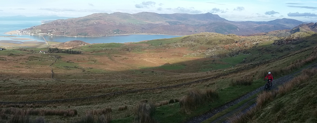
This mountain bike route of 14.7 miles starts from Capel Curig in Sonwdonia, North Wales. It follows part of the historic Sarn Helen trail to Dolwyddelan before returning below Moel Siabod. It is a ride on forest tracks and fun rocky double track with a fantastic boulder strewn descent to finish, all accompanied by stunning views.
1. Start from the car park behind Joe Brown’s in Capel Curig (GR720582). Turn left out of the car park and descend over the bridge then past the shops on the left to the triangular junction. Turn left then immediately right and follow the A5 through Capel Curig, in the direction of Betws y Coed. A little while after passing a school, on the left, the main road comes to a junction with a lane on the right over a stone bridge, by a house on the left (GR734572).
2. Turn right and cross the bridge, sparing time to look at the stunning river below, then follow the lane through the houses. At the far side of the houses the lane bears left before coming to a junction with a rocky track on the right (GR736567). The track on the right is the bottom of the final descent on this route. Go straight on and follow the lane for some time for a very gentle descent down the valley. Go past the second junction with a track on the right and stay on the lane as it bears left. Immediately after the lane bears right and comes to another junction with a track on the right leading into the trees (GR753574).
3. Turn sharp right and climb the wide forest track a short distance to a crossroad junction. Turn left and continue climbing past the forestry gate. The track climbs for a while before flattening off to traverse the hillside. After going across a concrete stream crossing the track reaches another gated junction (GR758572).
4. Turn right and climb the track to the next junction, then turn left to the following junction a short distance later (GR757569). Turn right then climb the track ahead, going past the logging tracks on either side. Eventually the track bears left before straightening out to undulate across the top of the hill. After quite some time the trail bears right, past a track on the right, before coming to a junction with a gated forestry track on the left a short distance later (GR769568). Go straight on and follow the track through a number of bends to a triangular junction. Turn right and descend through a dip before climbing a short way to the next junction, with a tarmac track on the right (GR773561).
5. Turn right to join the Sarn Helen trail and climb the steep lane. The climb starts with some rough tarmac that leads to a gate by a house on the right. Go straight on through the gate and continue climbing. The track then flattens off before coming to a junction, with a gate directly ahead. Bear right past the gate and descend the lane to a gate by some abandoned buildings, on the right (GR768555). Go straight on through the gate and climb the double track through a gap in the rocky ridge. The trail soon flattens off and undulates through a clear area in the trees. Follow the double track straight ahead, past a big rock wall on the right, to a crossroad junction (GR766551).
6. Go straight across the junction and follow the rocky double track ahead. This track soon flattens off and undulates across the top of the hill. There can be some sections of deep water on this trail, so your feet could get very wet. The track eventually descends through a loose S-bend before coming to a gate. Go through this gate, and the next, to come out at a tarmac junction (GR759543). Go straight on and descend the steep, and slippery if wet, single track lane. Near the end of the descent bear left, past a track on the right, just before coming to a junction with the A470 in the bottom of the valley (GR753538).
7. Turn left and follow the main road to the next junction a short distance later (GR755539). Turn right, following the sign for the station, and cross the stone bridge over the river. At the junction directly after turn right again to follow the single track lane in the direction of the station. At the following junction bear right and continue towards the station. Go straight on past the station to a gate at a farm. Go straight on through the gate and follow the dirt double track up a short climb. After reaching the top continue ahead for a short but fun, rocky descent. At the bottom bear right then left through a small bridge underneath the railway line. After the railway follow the grassy track, by the river on the right, to a gate by a house on the left (GR746527).
8. Go through the gate then continue straight ahead along the lane for about 1 mile, keeping the river on the right, until a junction on the edge of Dolwyddelan near the station (GR737522). Go straight on at the first junction then turn right immediately after, at the second junction, to cross the bridge over the river. Follow the wide road to a junction with the main road in the middle of Dolwyddelan, with a Spar on the left that is good for hot drinks and food (GR735524).
9. Turn right and follow the main road past the Elen’s Castle Hotel to a junction with a lane between the houses on the left, by a bus stop on the right (GR738525). Turn left and climb very steeply out the back of the houses to a junction with a rocky double track straight on. Go straight on and climb the double track that after a while bears left for a steep but short technical section of slate bed rock covered in loose rocks, with water usually running down it. It's doable but far from easy. After the slate the track bears right for a short but very steep section of tarmac to a junction (GR738527).
10. Go straight on and continue climbing the now shallow gradient. The tarmac soon gives way to a forest track and pine trees before reaching a junction with a wide forest track on the right (GR739528). Go straight on then at the next junction bear left and descend to a small concrete bridge. After the bridge stay on the main forest track and climb past the tracks on either side, before eventually descending to another concrete bridge. Directly after the bridge go straight on past a track on the right to a three way junction (GR731544). Turn right at this and the following two junctions, following the red cycle route signs, to eventually come out at a gate on the edge of the forest (GR732548).
11. Go through the gate and follow the rutted double track beneath Moel Siabod, on the left. After climbing gently for some time the track eventually descends through a couple of sweeping bends to a crossroad junction (GR737560). This is a good place to drop your saddle if you need to. Go straight on and descend the rutted track that after a while goes through a left hand bend into the trees. After this the track becomes strewn with big loose boulders. Continue descending the rocky track to a gate, directly after crossing a small bridge. Go through the gate then descend, past a house on the right, to finish at a junction with a lane (GR736567).
12. Turn left on the previously ridden lane and climb back through the houses, then over the bridge, to the junction with the A5 (GR734572). Turn left and follow the main road back through Capel Curig to the triangular junction at the Pinnacle shop and café where the main road bears right (GR721581). Turn left then immediately right and follow the lane past the left hand side of the shop. Continue straight on past Joe Brown’s then over the bridge for a short climb to the entrance of the car park on the right to complete the ride.