
Helvellyn – Sticks Pass
Lake District Mountain Bike Route Guide
Region:
Glenridding, Eastern Lake District
Difficulty:
Difficult
(Requires advanced skills and fittness)
Distance:
11.3 miles
Map:
OS Landranger 90
Route Text Download:
Helvellyn – Sticks Pass
GPS Download:
GPX and KML
(available via the full MapMyRide page for this route, on the right hand side of the page)
ViewRanger
Helvellyn - Sticks Pass Route
Back to Lake District
Route Guides
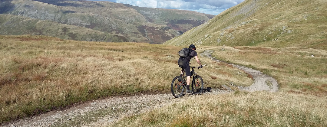
This mountain bike route of 11.6 miles starts from Glenridding in the Lake District. It climbs to the summit of Helvellyn via Glenridding Common before finishing with a descent of Sticks Pass. It’s a fantastic ‘proper’ mountain bike ride with lots of very technical descending, which is ample compensation for the sections of hike-a-biking.
1. Start from the junction on the main road at the bridge over the river, by the corner shop (GR386169). From the shop follow the lane up the left hand side of the river, away from the main road. After the lane passes the last house it changes into a dirt track that enters the trees. At the following junction go right to stay by the river. Go past the campsite on the left, to a junction with the lane at the other end (GR379169).
2. Turn right and cross the bridge, then turn left at the following junction and climb past the row of houses on the right. After the houses climb the concrete double track to Helvellyn YHA. At the YHA continue straight on along the main track and go through the gate to a junction with a gate a short distance later. Turn right before the gate and climb the steep, loose gravel switchbacks through the disused mine to a junction at top signposted to Brown Cove and Whiteside Bank ahead and Sticks Pass on the right (GR363174).
3. Follow the gravel track on the left up the valley. After some time the track comes to a junction (GR352166). Take the steep track on the right to start a long hike-a-bike. After climbing through a number of bends the track finally bears left and becomes rideable before reaching a junction on the ridge above Keppel Cove (GR339169).
4. Turn left and climb over Whiteside Bank. After descending down the other side continue straight ahead along the ridge track for a steep, precarious climb up Lower Man. At the top of the climb go straight ahead and descend a short distance to a junction (GR337154). Turn left and climb the track to a forked junction. Bear right at the junction and climb to the trig point at the summit of Helvellyn (GR341151). There is a stone shelter a short distance away on the right of the trig point, which is a good place to rest and refuel.
5. At the trig point turn 180 deg and descend back down the track you have just climbed, towards Lower Man. At the second junction turn right (GR337154). Climb a short distance to the top of Lower Man then drop your saddle if you need to for the steep, tricky descent. Follow the track along the ridge and climb over Whiteside Bank to the junction above Keppel Cove. Continue straight on along the ridge track and climb over the summit of Raise. Go down the technical descent on the other side then follow the track to the crossroad junction at the bottom (GR341182).
6. Turn right and start the descent of Sticks Pass. The descent begins with a smooth sweeping track but this soon pitches steeply downhill and becomes very rocky. It’s a very technical descent that will test even the best riders. The track eventually flattens off a little and follows the left hand side of the high valley to where the valley side turns right, on the left hand side of the old earth works. Follow the obvious trail right into the earth works and descend to a small wooden bridge in the sandy area (GR359180).
7. Go across the bridge then bear left and climb the bank to the singletrack at the top. Follow the singletrack, which soon bears right and becomes increasingly rocky as it descends. The track eventually bears left and crosses a very technical boulder field to a junction at the end of the high valley (GR362177). Turn right and descend the rocky track. After a while drop down though a number of bends until a signposted junction with a grassy track on the left, just after a right hand bend. Turn left and descend the grassy track to a junction with a wide gravel track at the bottom (GR363174).
8. Turn left and descend through the bends on the previously ridden track to the junction with the gate. Turn left and descend between the buildings to a gate. Go through the gate and descend straight ahead, past the YHA. Descend the concrete double track then go past the row of houses on the right. After the houses descend the lane right to a junction a short distance later (GR381170).
9. Turn right and descend over the bridge to a junction with a track on the left immediately after (GR379169). Turn left and follow the track by the river to go past the campsite. At the junction after the campsite go straight on and head back in to Glenridding to complete the ride at the junction with the main road (GR386169).