
Staveley - Three Passes
Lake District Mountain Bike Route Guide
Region:
Staveley, Eastern Lake District
Difficulty:
Difficult
(Requires advanced skills and fittness)
Distance:
25 miles
Map:
OS Landranger 90 & 97
Route Text Download:
Staveley – Three Passes
GPS Download:
GPX and KML
(available via the full MapMyRide page for this route, on the right hand side of the page)
ViewRanger
Staveley - Three Passes Route
Back to Lake District
Route Guides
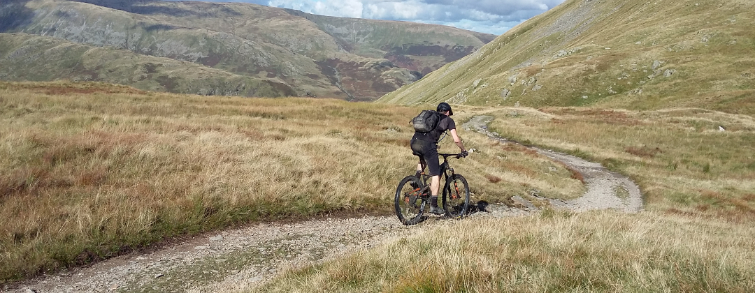
This mountain bike route of 25 miles is a beast of a Lake District ride starting in Staveley. It crosses three classic passes, which results in lots of technical, rocky riding. The climbs are big and brutal with lots of hike-a-biking but this pays back with seemingly endless technical descending. If you like big, hard rides this has got to be on your 'to do' list.
1. Start from the Mill Yard car park in Staveley (GR471983). Exit the car park and go past the first lane on the right to a junction with the main road through the village. Turn right and follow the road a short way to the next junction. Turn left and follow the road through the village, in the direction of Windermere, towards a junction with the A591. At the edge of the village, where the road turns left to meet the A591, go straight on up the dead end lane following the signs for Cycle Route No 6. When the lane ends follow the cycle track through the trees, then along the right hand side of the main road. Continue along this track to a junction with the third lane on the right, after the speed cameras, on the far side Ings (GR442988).
2. Turn right, following the cycle track that turns up the lane before it comes to an end, and climb the lane all the way to the top. Go past junctions with two lanes on the left then, after the crest of the climb, go through a small wood and past a third lane on the left. On the far side of the woods turn right up a wide gravel track (GR423006). Climb the rocky track past Dubbs Reservoir to a junction at the far end, halfway up the Garburn Pass climb (GR420031).
3. Turn right and climb the track to the top of the ridge. There are a number steep, loose and rocky sections on the way up to try and clean. When the track reaches the ridge go through a gate then follow the main track left then right, over the saddle, to reach the top of the Garburn Pass (GR436043). Drop your saddle if you need to as this descent is steep and covered in loose boulders, a real technical challenge. Go through the gate at the top of the descent and drop all the way down to the village of Kentmere. At the bottom the descent turns right to finish at a lane (GR454044).
4. Turn left on the lane then, a short distance later, follow it right and descend to the church. Bear left around the church and continue descending to a bridge over the stream at the bottom. At the junction directly after the bridge turn left and climb a thin lane (GR458039). Climb steeply to a T-junction, then turn left and continue climbing. Go past a track on the left then through the gate at the crest of the lane. Descend to a Byway on the right signed to Sadgill, which is on a left hand bend, just after a private track on the right (GR465050).
5. Turn right and climb the loose, rocky track through a few gates, to a gate at the top, on the ridge. Go through the gate then bear slightly left for a descent that drops steeply over big, loose rocks and pointy bedrock. Directly after a couple of loose the track comes to a junction with a gate straight ahead (GR481051). Go through the gate and descend the loose, rocky track all the way down to the buildings of Sadgill at the bottom. After the buildings follow the track across the bridge to the junction on the other side (GR483057).
6. Turn left and climb the wide rocky track between the drystone walls, up the right hand side of the valley of Long Sleddale. The climb begins as a gradual incline but it kicks up towards the end as it claws its way out the head of the valley. As the incline increases the track becomes littered with loose rocks and gravel. Eventually the track comes to some steep bends, paved with uneven boulders that lead to a gate. In the dry these give better traction but makes it feel like riding with square wheels, although it is still possible to ride them. After the gate follow the track left along a little plateau, past a signed but vague bridleway on the right, to the gate at the bottom of a steep winding track (GR478084).
7. Go through the gate and follow the track to the top of Gatescarth Pass. This last part of the ascent is mainly a push. Just after going over the top of the climb descend a short way to a gated junction (GR474092). Go through the gate and straight across the junction. This is the start of the very steep, loose and rocky descent to Haweswater. The trail contains a large numeber of tight, steep and loose switchbacks that will have your arms and legs burning well before the finish. It really isn’t for the faint hearted. After a gate near the bottom bear right and continue down the track to a junction a short distance before reaching the car park at the edge of Haweswater (GR468107).
8. At the junction turn sharp left and climb towards the waterfall. Don’t descend the other track on the left that follows the line of trees to the opposite side of the valley. This is the start of the Nan Bield Pass climb, another long hike-a-bike. Although the trail starts out rideable the boulder sections just get bigger and steeper. Climb and push up the track along the left hand side of the waterfall to Small Water, halfway up. At the lake follow the track right, over the stream, for a technical but rideable section anticlockwise along the edge of the tarn. This is a short respite from the hike-a-biking and all too soon it's time to shoulder the bike again for a scramble up a boulder strewn slope. Although it is a slog the top does get visibly closer every time you look up. Near the top, after negotiating a tricky slab, the trail heads off left for the final push to the top. A stone shelter soon comes into view on the ridge, in a saddle between the peaks, a good place to stop and regain some energy for the descent (GR452096).
9. Go straight over the footpath that traverses the ridge and descend the track that can be seen snaking off into the valley, a great sight after all that climbing. The descent starts with some steep and very loose switchbacks. This leads on to a fantastic section of boulder covered singletrack that traverses the side of the fell above Kentmere reservoir. Eventually the trail kicks up and bears slightly left over the shoulder of the fell. After the crest descend on the fast grassy trail, which is a little vague in places but hard to lose as there is only one trail to follow. Take care as the grass gives rise to higher speeds but it contains technical sections in the form of boulders and eroded earth. The grass ends at a gate directly before a ford. Bear right across the stream to the track on the far side of the wall, or use the bridge. Follow the rocky double track in the direction of the bridleway markers. The track undulates along the left hand side of the valley, going through a few gates on the way. Stay high of the track that can eventually be seen lower down on the right. The trail becomes vague near the end as it passes through a couple of fields. Keep going straight on through the bottom of the fields until the trail comes out at a junction with a lane by Overend farm (GR464058).
10. Bear left then go straight on through the gate directly after, marked as a bridleway. Don’t climb the lane on the left. After the gate go straight on and follow the singletrack to a junction with the rocky double track. Turn right at the junction then follow the main track as it bears left. A short distance later, where the double track turns right through a gate, go straight on, keeping to the wall on the right and continue straight on down the valley. Continue along this track until it finishes at a junction with a lane (GR461044).
11. Turn right on this previously ridden lane and descend to the next junction, on the edge of Kentmere. Go straight on and climb through a left hand bend to a junction. Bear right and descend the lane to the next junction, at the bottom (GR458036). Turn left and follow the lane along the bottom of valley. Go past Millriggs farm on the left and then ride through the trees. Go past the first junction on the right, then past a bridleway on the left. At the next junction on the right, marked as a bridleway, turn right and cross the bridge (GR456012).
12. Directly after the bridge turn left and go through the gate to follow the rocky track along the right hand side of the river. The track eventually bears right to a house. Climb up past the right hand side of the house to a junction with a lane a short distance later (GR454007). Turn left and follow the lane, generally downhill, to a junction with a bridge on the left. Go straight on and follow the lane back into Staveley. Follow the lane straight on through the village then go right at the forked junction (GR470986). A short distance later, at the main junction in the village, go straight on. Turn left at the following junction to return to Mill Yard car park to complete the ride.
Not only is there a bike shop at the start of the ride, which has a hose you can use to clean your bike post ride, there is a café, Hawkshead Brewery and an ice cream shop. Not far away in the village is a Spar and a local shop, both good for buying trail food.