
The Chatsworth Circuit
Peak District Mountain Bike Route Guide
Region:
Bakewell, The Peak District
Difficulty:
Moderate
(For Experienced Riders)
Distance:
18.5 miles
Map:
OS Landranger 119
Route Text Download:
The Chatsworth Circuit
GPS Download:
GPX and KML
(available via the full MapMyRide page for this route, on the right hand side of the page)
ViewRanger
The Chatsworth Circuit Route
Back to Peak District
Route Guides
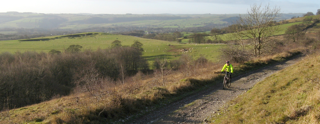
This is an 18.5 mile mountain bike route that starts in Bakewell and travels through the hills around the Chatsworth area of the White Peak. It is a ride of two halves with the first being on well draining gritstone trails and the second on loamy woodland trails and limestone double track. There is a lot of variety and some great descents, as well as stunning views.
1. Start from the old railway station car park on the Monsal Trail (GR222690). Exit the car park by the road and turn left to ride away from the station building. A short distance later at the next junction turn left. Climb the lane and cross the bridge over the Monsal Trail. Stay on the lane and climb past a bridleway on the right then the golf course on the left. After a while go through a right hand hairpin bend then follow the lane as it bears left to a junction with some tracks on the right, by Ballcross farm on the left (GR228694).
2. Continue straight on along the lane and go over the crest of the hill. Descend into the trees and go past a gate on the right. Keep straight on past the next gate as the lane steepens. At following junction, where the lane flattens off, take the wide dirt track on the right (GR235697). Descend this fast, loose track to where it becomes tarmac just before reaching Edensor. On reaching the tarmac go straight on into the village. At the far side of the village bear left at the forked junction then go through the blue gate and over the cattle grid to the junction with the main road (GR251700).
3. Turn right and follow the main road along the valley. Go past the entrance to Chatsworth House and stay on the main road as it climbs right. At the top the road bears left, keep your eyes peeled here for the deer, before descending to a junction with a road on the right to Calton Lees (GR258686). Stay on the main road and descend to a left hand bend that leads to a thin bridge over the river at the bottom. Go over the bridge to a junction with a lane on the left at the old gate house, near the end of the right hand bend (GR262684).
4. Turn left and climb the lane to Beeley Hilltop farm. At the farm continue straight on and climb the gritstone double track. Stay on this track, going through a few bends on the higher section, until it ends at a junction with a road (GR286680). Turn left and climb the road to the second junction, a crossroad junction with a dirt track on the right, at the top of the hill (GR296673). Turn right and follow the wide potholed track to another crossroad junction. Go straight across the main road and descend the lane to a junction by a building on the left (GR292654).
5. Go straight on, where the lane turns left, and follow the double track between the drystone walls through the trees. Continue straight on and after a while go down a fun rocky descent. In the middle of the descent follow the track right then left before finally coming to a lane at a farm. Go straight on down the lane to the next junction, where the lane turns left (GR287640). Go straight on down the uneven patched tarmac. Directly after passing a building on the right the tarmac ends with a steep drop into a boulder strewn chute. At the end of the rocks, where the tarmac returns, turn hard left and drop to a junction with the main road (GR284632).
6. Turn right and descend steeply down the road that, after a short while, goes through a sharp right, left, right series of bends. At the junction directly after the second right hand bend turn right (GR281630). Follow the lane through the houses then a short distance later, at the next junction, go straight on for a steep climb through a tunnel of trees to the next junction (GR279631). Turn right then climb through a left hand bend to a high lane that traverses the hillside. At the next junction, with a very steep lane on the right, continue straight on (GR275635). At the following junction go past a lane descending to the left and continue traversing the hillside straight on. After a while the lane ends at a junction. Turn left and descend a short way to another junction (GR269639). Turn right and follow the road between the stone walls to continue traversing the hillside. After a while the road comes to a junction with two lanes on the right, set close together (GR269645).
7. Take the second lane on the right, directly after the 30mph sign, marked as a dead end. Climb the lane through the houses, going past a bridleway signed to Tinkersley on the way up. At the last house continue straight on up the woodland sinlgetrack to a three-way junction over a stream (GR271647). Turn left and descend the singletrack through trees. Follow the track straight ahead on a number of short climbs and descents as it traverses the hillside until it comes to a gate in a drystone wall. After the gate turn left and descend a short way to a junction (GR265653). Turn right and climb a short way to a gate, with a track climbing off to its right. Go through the gate and follow the track across the hillside to where it abruptly ends at a road (GR266658).
8. Turn left and descend the road through some hairpin bends before a fast blast to a junction on the edge of Rowsley (GR260661). Turn left and follow the road to where it ends at a junction on a bend of the A6. Turn right and follow the A6 main road over the river then bear right through the village to a junction with a lane on the right, directly after the Peacock Inn, at the end of the bend (GR256658).
9. Turn right and follow the lane past the local shop, on the left, to where the lane becomes limestone double track at the edge of the village. Climb the double track towards Manners Wood. After a while follow the track left, past some gated tracks on the right (GR250668). The track then flattens off for a bit before kicking up to another junction. Bear left and descend the track to the next junction with the single bar forest gate (GR244670). Turn right then immediately go up the trail, to the right of the double track that bears left, and climb into the trees. Climb the steep woodland trail to a junction at the top (GR244673).
10. Turn left to the next junction, a short distance later, then turn right and climb the wide, often muddy, track. The track soon bears left and flattens off to cross the top of the hill. It can still be quite muddy here. After a while go through the drystone wall on the right for some nice singletrack through the trees. At the edge of the trees the track bears right to a gate (GR241679). Go through the gate then head straight on, following the bridleway marker, and descend the increasingly steep field. Continue straight on to the bridleway marker in the dip, where slowing down can be interesting if wet. At the junction just after go straight on then follow the double track left to a gate (GR242685).
11. Go through the gate then turn right and descend through the field staying by the wall on the right. At the next junction, at a gate on the right, bear left and follow the singletrack across the field to another gate. Go through the gate then descend the wide, rocky track through the trees to a gate at the other end (GR246689). After the gate go straight down the stepped field to a marker post just before the next clump trees. Turn right directly at the post and follow the vague track along the grassy bench in the field to a junction with a number of tracks near the tree line. Turn square left and descend the very vague track across the field, in the direction of Chatsworth house, to the road (GR252693). Turn left and follow the road to the following right hand bend. Before the end of the corner bear left off the tarmac onto a wide bench cut bridleway across the field (GR252697). Go straight ahead and follow this trail as it bears left and gently descends to the entrance of Edensor, on the left (GR251700).
12. Turn left into the village then at the forked junction take the right hand lane to climb past the right hand side of the chapel. Continue straight on and climb out of the village to a junction at the end of the tarmac (GR246697). Go straight on and climb the gritstone double track through the trees to where it eventually finishes at a junction with a lane (GR235697). Turn left and climb the steep lane to the top of the hill. After the top descend to a junction with some tracks on the left at the very top of Manners wood, next to Ballcross farm on the right (GR227694).
13. Take the second track on the left, a thin track that drops straight ahead into the trees. This rooty woodland track soon bears left and encounters a very deep rut before reaching a crossroad junction (GR227692). Go straight across the junction and continue descending. The trail at this point can get a bit muddy, but in a fun slippery kind of way, as it goes through a number of turns and down a section of rooty drops. The trail then crosses a golf course before dropping back into the trees. At the next junction go ahead across the golf course access trail. A short distance later, at the next junction, bear right down a short rocky track that ends with a step to a junction with a lane (GR223690). Turn left and cross the bridge over the Monsal Trail to the following junction. Turn right and return to the old station car park to complete the ride.