
Loughrigg Fell
Lake District Mountain Bike Route Guide
Region:
Ambleside, Southern Lake District
Difficulty:
Moderate
(For Experienced Riders)
Distance:
19.3 miles
Map:
OS Landranger 90
Route Text Download:
Loughrigg Fell
GPS Download:
GPX and KML
(available via the full MapMyRide page for this route, on the right hand side of the page)
ViewRanger
Loughrigg Fell Route
Back to Lake District
Route Guides
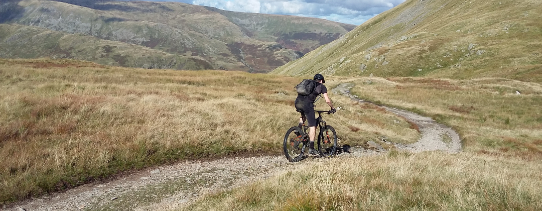
This mountain bike route of 19.3 miles starts from Waterhead, just south of Ambleside, in the Lake District. It circles Loughrigg Fell and also takes in Black Fell and Little Langdale. The climbing is less arduous than most Lake District routes as the fells in this area are lower than those to the north. That doesn't mean the descents aren't any good, there are some superb ones, especially from Iron Keld. The riding is rocky, so the trails are pretty weather proof, and being surrounded by higher peaks means the route is fairly well sheltered in bad weather too.
1. Start from the Waterhead car park by the Regent Hotel (GR367033). Turn right out of the car park and head towards Ambleside. Follow the main road through a long right hand bend then turn left at the junction signed for Coniston and the A593 (GR373038). After bearing right turn left at the next junction, again signed to Coniston. Cross the small stone bridge then at the junction immediately after turn right down a small lane (GR371039). Follow the lane beside the river. Just after passing a stone bridge on the right follow the lane left and over a cattle grid to a junction with the next lane on the left (GR370045).
2. Turn left and go over another cattle grid then climb the steep lane. After a while follow the lane through a tight left then right hand bend at Brow Head Farm. Continue climbing the lane ahead to where the tarmac ends at the entrance to a house on the right. Go straight on and climb the rocky double track. Continue following the double track ahead to a gate at the top. After the gate follow the track ahead on the flat for a short distance before descending steeply to a stream crossing at the bottom (GR356043). Directly after the stream bear left up a short climb. At the top follow the track straight on and descend across the flank of Loughrigg Fell, on the right. The track soon begins to follow a drystone wall on the left. Follow the wall and bear right around the fell. At a forked junction take the left hand track to stay by the wall on the left. Continue descending the singletrack for a while to gate at the trees. Go through the gate for a steep, loose and rocky section that ends at a junction by some cottages (GR347041).
3. Go straight ahead on the lane to the left of the cottages. After the cottages bear left and descend to a triangular junction. Turn right and ride a short way to the next junction. Turn left and descend the steep lane down to a four-way junction with the main road at Skelwith Bridge (GR344035). Go straight ahead along the main road and cross the bridge over the river. At the junction directly after the bridge, where the main road turns right, go straight on up the lane. Climb the lane through a left hand bend to a junction (GR348029). Turn right and climb the lane to the next junction. Turn left and continue climbing to a small triangular junction (GR348023). Turn right and follow the lane until it eventually descends to a junction on a left hand bend with a gated track straight on that climbs into the trees, signposted as a bridleway to Sunny Brow (GR346016).
4. Go through the gate and climb the steep track through the trees. At the junction at the top go straight on past a steep track on the right. Follow the singletrack ahead, by the wall on the left, to the next junction with the signpost (GR344008). Turn right, following the sign for Iron Keld, and climb the steep, rocky singletrack. If you are a very good climber it’s just about doable in the dry but for most this section will be a push. After a while the climb bears right before flattening off and becoming properly rideable again. After going through a stream crossing the trail kicks up again. Continue climbing, going through a gate on the way up, until the track bears left to a junction at the top. Turn left and descend the wide track to where it ends at a gate (GR337004).
5. Go through the gate then turn right and follow the wide track to the next gate on the right a short distance later, signposted to Black Crag and Arnside (GR336005). Go right through the gate then climb the rocky double track. Continue straight on to the top where the track bears left to a gate. After the gate follow the double track straight on to start the fantastic 1.5 mile Iron Keld descent. Follow the trail as it flows down the fell and over some nice rock sections. About halfway down, by a house on the left, the trail goes through a gap in a drystone wall before coming to a junction. Go straight on up the short climb, past a track descending to the left, then continue straight ahead down the rest of the descent. Keep to the obvious trail that eventually ends at a gate and the A593 (GR335029).
6. Turn left and climb the road. Go past a junction on the right signed to Colwith and continue climbing, with the woods on the right. At the top of the woods where the road flattens off, directly after a blind left hand bend, the road comes to a junction with a lane on the right (GR329022). Turn right onto this lane then immediately after at the four-way junction go straight on. Climb the steep lane to the next junction (GR326019). Turn right and follow the lane along the top of the hill before descending through a couple of bends to the farm buildings at the bottom where the tarmac ends. Go straight on through a gate to leave the tarmac behind. Climb the wide hardpack track through a number of bends and over some interesting rock features. After the climb descend the rocky track ahead to a gate by the old quarry. Go through the gate and head straight on down the track to where it ends at a junction with a lane at the houses (GR317019).
7. Turn left then bear right between the houses. On the following left hand bend take the second gravel track on the right that descends directly by a stone wall, bearing left to a gate. Go through the gate and descend the rocky double track through a couple of bends to a three-way junction (GR315018). Take the middle, slate strewn track descending into the gully ahead. The slate soon gives way to a hardpack double track that descends through a couple of bends before climbing to a junction (GR313020). Turn left and climb up the right hand side of the valley. After some time go over the crest of the climb then descend to a gate at a farm (GR308014).
8. Go through the gate to the junction immediately before the buildings. Turn hard right and go through the gate for a steep, slate double track climb. The climb soon flattens off and bears left before kicking up again for the next steep section. At the top follow the track straight on as it descends through a long shallow dip. Climb right then left out of the dip for the last steep section to the top. Continue ahead on the slate double track for a fast descent that eventually comes to a gate. After the gate continue descending the double track to a junction (GR307027). Turn left and descend the slate double track to the next junction a short distance later. Take the right hand double track and continue descending. At the bottom of the descent follow the track right around a white house then over two small bridges to a junction with a lane (GR300032).
9. Turn right and follow the lane along the left hand side of the valley. At the following road junction continue straight on. Once past the end of Little Langdale Tarn, on the right, the lane kicks up and climbs to a four-way junction at the top (GR314034). Turn left and climb the lane past a farm and on to a gate. Go through the gate and keep to the hardpack gravel track. The track eventually comes to a gate at the trees just after it starts descending. After the gate go straight on, past a track on the left, and descend the big, loose rocks. At the end of the rocks follow the tarmac straight on to a junction with a lane at the bottom (GR327045). Turn left and ride past the YHA then at the following junction bear right and go over the river to the junction in the centre of Elterwater, where the lane turns right. Go straight on between the pub and the shop to a junction at the other side of the village (GR329050).
10. Go straight across the main road then climb the lane on the other side. Climb through a left, right then left hand bend to a junction (GR331052). Turn right and continue climbing the tarmac. At the top of the climb follow the lane left and go past High Close YHA before descend to where the lane ends at a junction (GR340054).
11. Go straight ahead, across the lane, to a gate at the start of the track on the opposite side. From this point on be careful of walkers as this is a very popular area for day trippers. Go through the gate and descend to the next junction then go straight on and continue descending to the next gate. After the gate descend to a short, technical climb left over a stone flag bridge. After the bridge go straight ahead and descend the track across Loughrigg Terr, all the way to the junction at the woods (GR348060). Turn right and follow the track down through a few steep turns. The track then straightens out and descends the rest of the way to the edge of Rydal Water. Continue ahead on the track by the lake until it comes to a junction (GR359060).
12. Take the right hand track and climb a short way to the top. At the top go straight on through a gate and descend the lane. Go past a car park at the bottom to where the lane ends at a junction, there is often an ice cream van here (GR366059). Turn right and follow the lane for around two miles to the previously visited junction with the A593 on the edge of Ambleside (GR371039). Turn left and go over the small stone bridge then on the other side follow the one-way system left. Get in the right hand lane then turn right at the next junction. Turn right and follow the main road straight ahead all the way back to the Waterhead car park to complete the ride.