
Cadair Idris
North Wales Mountain Bike Route Guide
Region:
Snowdonia, North Wales
Difficulty:
Difficult
(Requires advanced skills and fitness)
Distance:
15.5 miles
Map:
OS Landranger 124
Route Text Download:
Cadair Idris
GPS Download:
GPX and KML
(available via the full MapMyRide page for this route, on the right hand side of the page)
ViewRanger
Cadair Idris Route
Back to North Wales
Route Guides
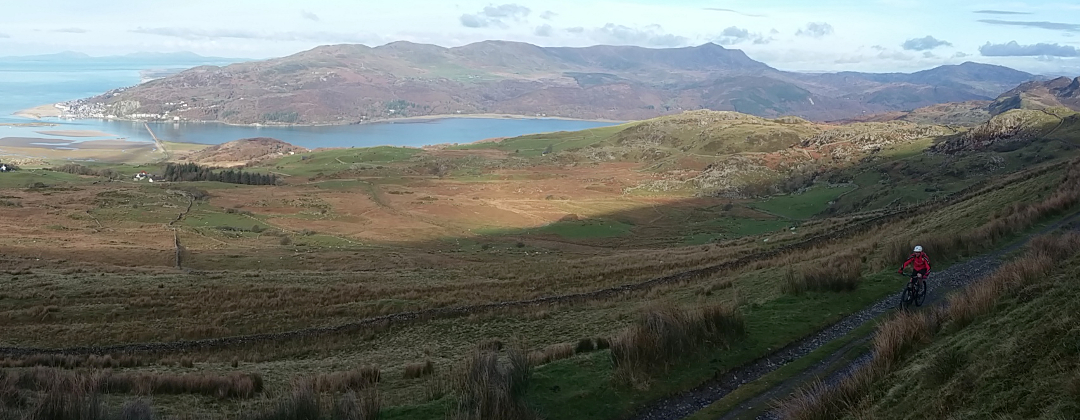
This mountain bike route of 15.5 miles takes you to the summit of Cadair Idris, an 893m mountain near Dolgellau on the southern edge of the Snowdonia National Park. It is a big mountain with a good variety of trails including double track, grassy trails, sinlgetrack and a final 1.5 miles of boulder strewn trail at the top. While there is some hike-a-biking the mountain is mostly ridable, if you have the legs for it.
1. Start from the Community Centre car park in Abergynolwyn (GR677069). Café Ceunant is situated in the Community Centre and there are public toilets just around the right hand side. Exit the car park onto the main road and turn left to go past the front of the Railway Inn. After the pub go past a junction with a lane on the right, then a playground, to a junction with an access lane on the right directly after. Turn right and follow the track beside the river on the left to a small bridge that crosses the river (GR676070).
2. Turn left and cross the bridge then go up the stone flagged path towards the house shortly after. Bear right across the front of the house to a short flight of steps leading into a small field. Follow the grassy track just to the right of the steps, which soon bears left and climbs to rejoin the track at the top of the steps. Bear right and follow the singletrack up the left hand side of the valley, with the river a long way down on the right. After going through the trees the track traverses a grassy hillside before coming to a forked junction (GR662074). Take the track on the right and descend into the trees. At the bottom continue straight on to the gate by a house. After the gate go straight on for a short distance to where the track ends at a junction with a lane at Pont Y stumanner (GR660078).
3. Turn right and cross the bridge then follow the lane to a four-way junction. Go straight on across the junction and follow the lane up the valley. After a while the lane passes a small parking/picnic area on the left before dropping down through the trees to Llanfihangel-y-pennant (GR672088). At the junction after the chapel go straight on and continue following the lane through the valley, towards the mountains ahead. After a while bear left then right on the bridge over Afon Cadair then continue along the lane until it bears left to a gate (GR676099).
4. Go through the gate and climb the steep gravel double track for a while to the next gate, at a junction with a track on the left (GR675105). Go straight on through the gate and continue climbing the track through a series of bends. After climbing for quite some time the track goes down a short descent then through a left hand bend before reaching a gate directly after (GR678114). Take note of the grassy track heading through the boggy ground on the outside of the bend before the gate. This is used on the way back down. Go through the gate for a gentle climb on the double track, which gradually bears left before coming to a gate at the sheep pens (GR677122).
5. Go through the gate to a three-way junction directly after. Follow the track on the right through the gates to a ford. Bear right through the ford, after which the track becomes very steep. Climb the track through a few bends where it becomes grassy before reaching to a junction. Take the right hand track for a steep, straight, grassy climb to a gate (GR678125). Follow the bridleway arrows through a small gate to the left of the main gate then go up the steep grassy trail that heads off to the right, which climbs along the right hand side of a ditch. This steep grassy track gives great views down the valley just climbed before bearing left around the hill to a gate with a stile on the left (GR682126).
6. Go through the gate and climb the singletrack straight ahead that goes up the left hand side of the valley. This is the Pony Path, an interesting climb of grass, ruts and rocks. It becomes trickier as you climb, though as the gradient never becomes too steep it's technically possible to ride it all. That’s not to say most won’t have to push at some point. At the top the track bears left over a crest before descending right to a gated junction (GR691135).
7. Go through the gate and bear slightly right, past the footpath on the left, to climb the wide gravel track that marks the start of the final 1.5 miles of rocky riding to the top. The track soon comes to a set of steep, rocky steps. This is the first of quite a few hike-a-bike sections, going up steps then bouldery scree. In between the steps and scree are some ridable sections but they can be quite difficult. Eventually the track reaches the ridge above Llyn y Gadair. This part of the trail is flatter and more ridable but still very challenging, with boulder fields to negotiate. Near the summit the track steepens again for the final section of hike-a-bike to the top. Continue along the trail to the start of the final 100m or so that would be, if you climbed it, a precarious, rocky scramble up a ‘V’ shaped channel (GR710130). At this point turn right off the main track to follow a grassy trail between the large boulders. A short distance later the trail comes to a large cairn on the right hand side of the summit. Bear left around the cairn then follow the bouldery track, of which you can initially only make out the first few meters, up through the scree to the summit (GR711130).
8. Once you have taken in the views, or stared at the inside of a cloud, it’s time to head back down the way you came up. Push back down the scree path to the large cairn then bear right on the grassy track leading back to the bottom of the ‘V’ shaped channel on the main track. Form here everything is rideable. Descend all the way to the three-way junction at the sheep pens (GR677122). Once there bear left through the gates and descend the previously climbed double track. The track gradually bears right before coming to a gate (GR678114). Directly after the gate, on the right hand bend that leads to a short climb, bear left and follow the grassy track through the boggy field to head straight on towards the drystone wall. The really boggy bit is just before the wall. Bear right at the wall and follow the grassy track beside it. The track soon goes over a crest where it firms up for a fast and fun singletrack descent that stays by the wall. After some time the track bears right away from the wall down a small, grassy ‘V’ shaped gully, directly after the hillside on the right drops away (GR667107). You will probably overshoot this the first time and end up in the small open grassy area directly after wondering where the trail went.
9. Turn right and descend the ‘V’ shaped gully down the tight, grassy singltrack between the bushes. The trial becomes rockier as it enters the trees before coming to a stream crossing at the bottom. Use the ford or rocky bridge to cross the stream then follow the grassy track on the other side up to a junction with the previously ridden double track, at the gate (GR675105).
10. Turn left through the gate and descend the double track to retrace your wheel tracks all the way back to Abergynolwyn. Follow the lane along the bottom of the valley, through Llanfihangel-y-pennant, to the four-way junction then take the middle lane, going straight on, to the junction with a track on the left directly after Pont Y stumanner (GR660078). Turn left and follow the track to the junction at the house a short distance later. Go through the gate on the left and follow the track along the valley to a junction at the top of a grassy climb (GR662074). Go straight on up the valley and continue along the trail until it descends, down the short flight of steps, past the house on the edge of Abergynolwyn. Bear left over the bridge then on the far side turn right and follow the access lane back to the main road. Turn left and follow the road back to the Community Centre car park, a short distance later on the right, to complete the ride.