
Clapham and Pen-y-ghent
Yorkshire Dales Mountain Bike Route Guide
Region:
Clapham, Yorkshire Dales
Difficulty:
Difficult
(Requires advanced skills and fitness)
Distance:
32 miles
Map:
OS Landranger 125
Route Text Download:
Clapham and Pen-y-ghent
GPS Download:
GPX and KML
(available via the full MapMyRide page for this route, on the right hand side of the page)
Photo Gallery
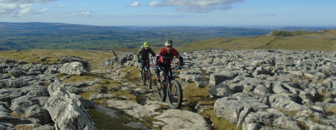
This is a 29.5 mile mountain bike ride starting from Clapham on the western edge of the Yorkshire Dales, which is also home to Ingleborough cave. The route heads east from the village following the Pennine Bridleway before doing a loop around Pen y Ghent, then returning on more of the Pennine Bridleway. The route uses a lot of the rocky Dales double track with some great sections of singletrack and some grassy riding to Foxup.
1. The ride starts from the National Park Car park in Clapham, with the Clapham Bunkhouse, Café and Bar right at the entrance (GR745692). At the exit of the car park turn right and follow the road to the junction in front of the church. Turn right onto the wide rocky track, then at the next junction immediately after turn left. Climb the double track through two tunnels then continue up the steep climb to a three-way junction at the top (GR751694). Take the track on the right and follow the double track between the stone walls. The track starts descending gently at the first set of trees but steepens just before the second set trees. Keep descending the track until it reaches a crossroad junction with a lane (GR769692).
2. Turn left and follow the lane through a dip before climbing through a couple of bends. Near the top, where the tarmac gives way gravel, continue straight on. After a while the track descends to a junction with a track on the right, signed for the Pennine Bridleway (GR772706). Turn right and descend the rocky track to a river crossing. After crossing the river follow the track to a junction with a gate on the left. Go straight on for a wonderful, winding singletrack trail that generally descends between the walls. After some time the track becomes a wider and rocky track that descends past a stone building on the right before reaching a forked junction on the outskirts of Wharfe (GR782697).
3. Take the singletrack on the left to stay high of the wide track descending to the right. At the following junction at a cottage bear left and climb the muddy track between the walls. On reaching the cottage at the top go straight on and descend the lane to a junction shortly after. Turn left then immediately after follow the lane right to a junction with a road (GR784695).
4. Turn left and follow the lane up a very gentle climb. Continue ahead along the lane, going between some stone buildings on the way up, to a large crossroad junction at the top (GR804691). Go straight on and descend the wide road through a few bends. At the bottom go past the Helwith Bridge Inn, on the left, before going right over a bridge to a junction (GR813695). Turn left onto the B6479 main road and go past a rocky track on the right, used on the return leg of this route. The main road initially goes up a short climb before a long gentle descent to Horton in Ribblesdale. At the village follow the main road as it bears left over a stream then past a church before turning right at the Golden Lion Hotel. Continue along the main road past some fields then on to a junction with a track signed for the Pennine Way directly at the end of the row of houses on the right (GR809724).
5. Turn right and climb the rocky double track to a gate at the edge of the village. At the junction immediately after the gate go straight on up the long, rocky double track of the Horton Scar climb. At the top the double track ends at a gated junction (GR823743). Go through the gate then straight on along the muddy singletrack signed as the bridleway to Foxup. After about 20m the singletrack becomes a wide grassy, sheep clipped track. Do not follow this obvious track but bear right on the vague track through the boggy grass on the right, which climbs diagonally to a gate in the wall on the right (GR824745).
6. Go right through the gate then climb the track that initially bears left through a few bends. After a while the track becomes a soft, mossy, wet and grassy track that climbs straight ahead to a junction (GR828747). Go straight on and continue climbing the (usually) boggy track, now following a wall on the right. After a while the track goes over the top of the hill then descends to a hardpack track at the bottom. Keep to this track and follow it through three stream crossings in steep dips. After this the track becomes grassy and goes through a long section of lumpy, grass covered limestone pavement, which is deceptively tricky. Eventually the trail bears left and descends then bears left again becoming quite steep for a grassy descent that ends at a gate just after a stream crossing. Go through the gate bear very slightly right on the grassy trail that traverses the side of the hill. After some time the trail reaches a wall ahead, where it bears left for another steep grassy descent that comes to a gate. Go through the gate then descend across the field to a gate on the opposite side. Go through this gate then bear left and descend to a gate at the farm at the bottom (GR871767).
7. Go through the gate then turn right out of the farm. Turn right onto the lane and follow it down through the valley. At the road junction on the far side of Halton Gill go straight on and continue down the valley following the river. Go straight on at the next junction, with a track on the right going over a stone bridge, to the following junction just before the lane kicks up a very short climb (GR899743). Turn right and follow the rocky double track that leads to a bridge over the river with a junction directly after (GR898741). Turn right and go through a gate then climb the very steep limestone double track out of the valley, going straight on through all the gates. Eventually the incline starts to reduce, finally becoming a gentle climb across the hill. Continue following the double track straight ahead until it finishes at a junction with a lane (GR856729).
8. Go straight on and climb the lane to a cattle grid at the top. Continue along the lane, descending past a house on the right and through a dip before climbing to another cattle grid directly before a junction with a track on the right (GR842714). Turn right and follow the track to a house then continue ahead following the track past the right hand side of the house. The track then climbs to a three-way junction below Pen y Ghent (GR835718).
9. Turn left for a gentle climb on the rocky track that soon goes over the crest of the hill. Continue following this track for a long rocky descent, going through some gates on the way down, to a three-way junction (GR818697). Turn right for more rocky descending to a junction with the previously ridden road at the bottom (GR814695). Turn left onto the road to the next junction a short distance later, then turn right and cross the bridge then go past the Helwith Bridge Inn on the right. Climb the road through a few bends to the crossroad junction at the top (GR804691).
10. Go straight on and descend the road through a dip. Shortly after climbing out of the dip the road comes to a junction on the left with a grassy track between stone walls signed as the Pennine Bridleway (GR799691). Turn left and descend the grassy track a short way to a gate bear right through the gate the climb gently across the field to a gate underneath a large tree. Go through the gate and climb the singletrack between the walls to a gated junction at a farm (GR793689).
11. Go through the gate and climb the double track straight on past the buildings on the right. Continue climbing the track to a junction directly by a house on the right. Turn left and climb the dirt track to a gate. After the gate follow the track right, then left, as it climbs to a gate near the top of the hill (GR790684). Go through the gate and straight on over the hill for a gravel double track descent. Eventually the track bears left and becomes a tarmac lane, finishing the descent at a gate in Feizor. Go through the gate then follow the lane right through the village. Go past Elaine’s Tea Roomson the right, which has lovely cake and tea, then continue ahead along the lane to a gated junction with a concrete track on the right signed for the Pennine Bridleway, immediately before a barn (GR789676).
12. Turn right through the gate and descend the concrete track. Continue ahead down the track, going over a couple of rocky sections on the way. The trail then becomes a fun, winding singletrack descent between the drystone walls. At the stone building follow the track right and continue descending to where the track widens before reaching a junction (GR776684). Take the second track on the left, signed for the Pennine Bridleway, and follow the hardpack track down to a river crossing. Go over the stone bridge then continue ahead along the track to a junction with a road on the edge of Austwick (GR771687).
13. Turn right on the road and follow it to the next junction, with a track on the left, signed for the Pennine Bridleway (GR774691). Turn left and climb the steep rocky double track, going straight on across the previously visited crossroad junction on the way up. Continue ahead along the wide track until it eventually reaches a three-way junction (GR751694). Go straight on then take heed of the tunnel warning signs before descending the wide rocky track. The first tunnel, although short, is pitch black. After the second tunnel the track ends at a junction on the edge of Clapham (GR746694). Turn right then at the next junction directly after turn left. Follow the lane down through the village to the National Park car park on the left, with the Clapham Bunkhouse, Café and Bar at the entrance, to complete the ride.